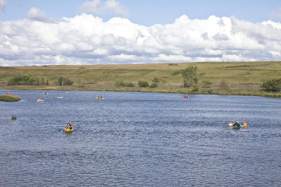
This augmented reality guide was designed to help visitors navigate Freshkills park, which is twice the size of New York's Central Park.
Freshkills Park+ 2011
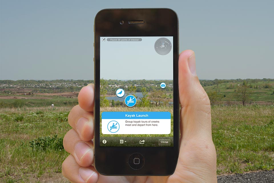
An augmented reality (AR) application for smartphones that allows visitors to Freshkills Park in Staten Island to navigate and understand features of the site as well as its transformation from landfill to park. The former landfill presents a unique challenge for visitors since the installation of foundation-supported signs is prohibited by the presence of vast underground landfill infrastructure. The solution that Freshkills Park+ proposes is a virtual wayfinding system that consists of descriptive icons and texts overlaying the camera view of a user mobile device. Visitors see only the relevant information based on where the device is pointing, acting like a smart compass that helps them virtually navigate the park.
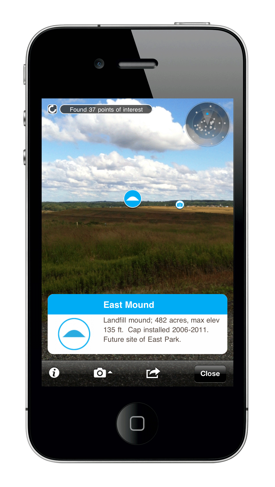
As visitors point their device to different sites on the landscape they learn about what they see.
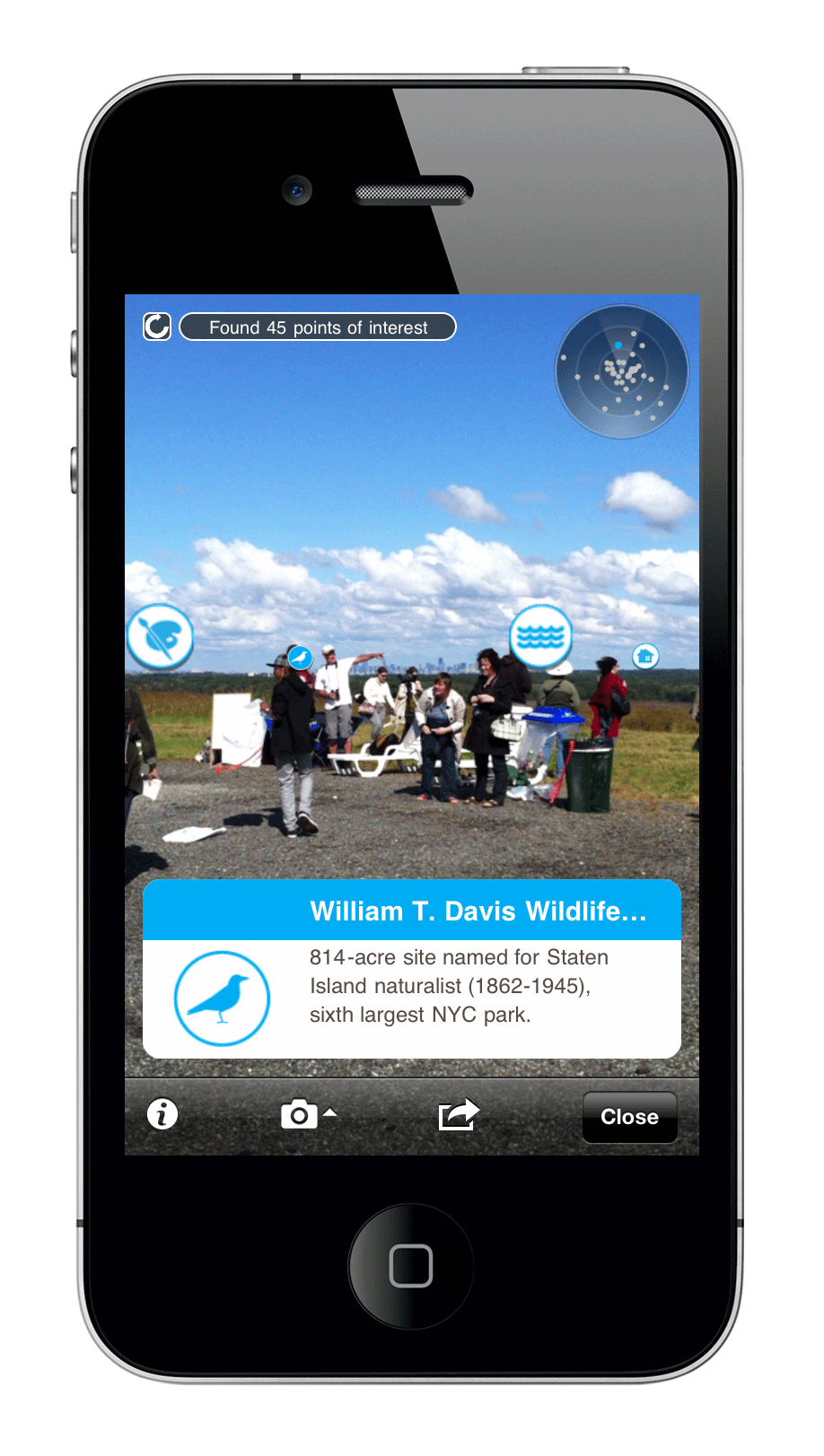
Visitors could tap on the info overlays to access other media and info related to what they point at.
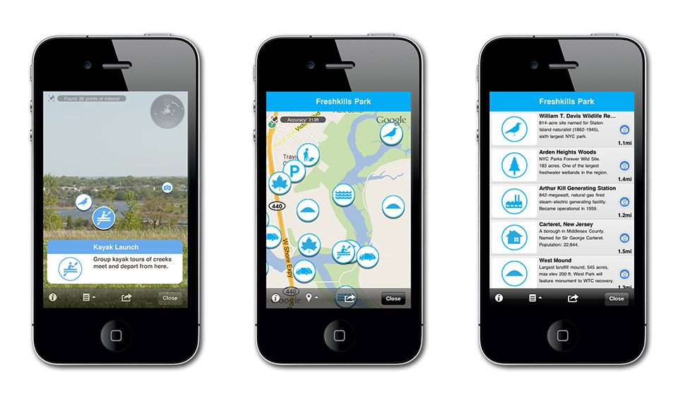
The app can be experienced as augmented reality, a map or a list of locations.

Icons representing the locations of facilities and activities of the park were used as an alternative to traditional signage, which is forbidden on this landfill.